Andrea Scuderi
Senior iOS Software Engineer
Swift and Objective-C Developer
AWS Certified Engineer
The only iOS app that overlays slope gradient, speed, and altitude on your GPS routes. Import any GPX file or Apple Watch workout. Professional analytics. No account required.

Free to download. Explore demo tracks of Alpe d'Huez, Stelvio & Mont Ventoux instantly — no subscription required to try.
TrackyzerPro gives cyclists, runners, and hikers professional GPS analytics — slope gradient maps, elevation profiles, and speed charts — right on their iPhone.
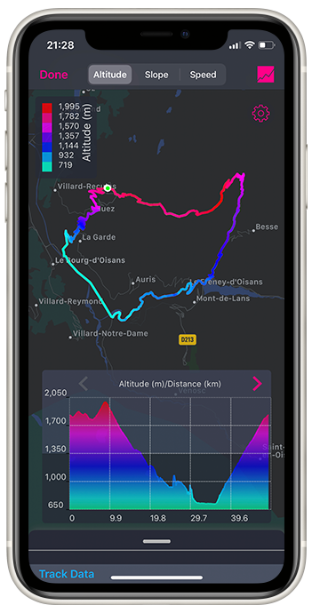
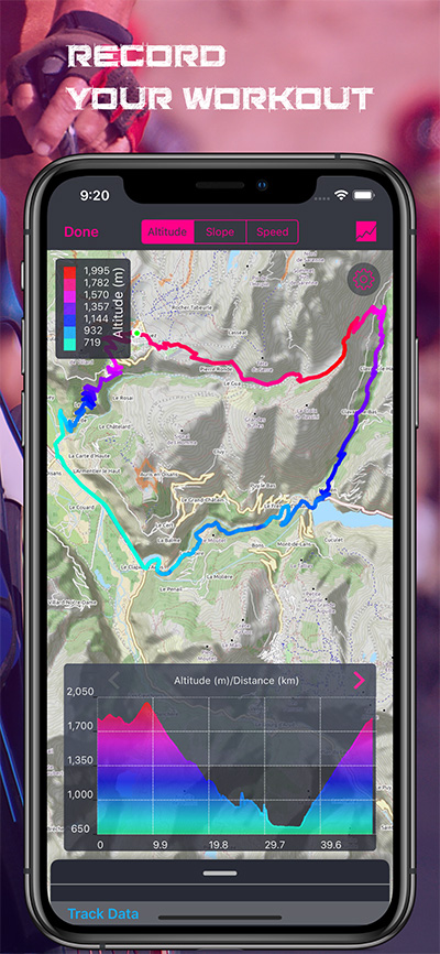
See altitude, slope, and speed color-coded on your map. Switch layers instantly — pinpoint the hard sections at a glance.
Accurate GPS logging on iPhone and iPad — speed, altitude, distance, and coordinates recorded every second and saved automatically to iCloud.
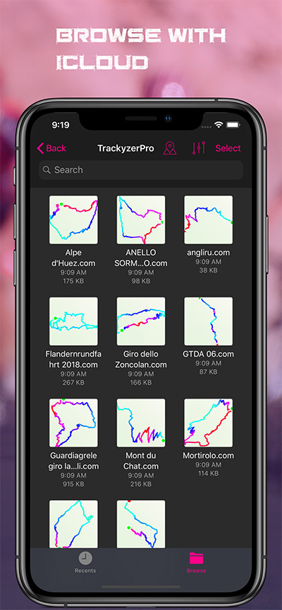
All your tracks synced across every iPhone and iPad via iCloud — always backed up, always available.
Open any GPX file from Strava, Komoot, Garmin, or any other app and instantly see slope, elevation, and speed analysis.
Export your ride as a data card — map, stats, elevation profile, and slope histogram in a single shareable image.
Start exploring immediately — no registration, no email, no subscription needed to try the included demo tracks of iconic climbs.
Download TrackyzerPro and immediately explore GPS tracks of the world's most iconic cycling climbs: Alpe d'Huez, Stelvio, Mont Ventoux, Mortirolo, Angliru, Zoncolan — slope maps, elevation profiles, and speed analysis included.
Unlock recording, GPX import, Apple Watch import, and iCloud sync with a subscription.
Your tracks live in iCloud — backed up automatically and accessible on every device you own.
Real-time speed, altitude, and distance displayed on the map as you ride — every stat you need, at a glance.
Subscribe once and use TrackyzerPro on all your iPhones and iPads — no extra purchases.
Import any GPX track and overlay altitude, speed, or slope in vivid color — see the story behind every route.
Runs natively on iPhone and iPad with Apple Maps, OpenCycleMap, and OpenStreetMap. Six chart types — altitude and speed plotted against both distance and time. Full portrait and landscape support. Import and export GPX files to any app. Share routes and stats directly to social media.
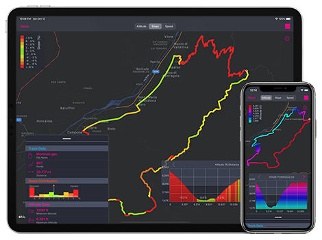
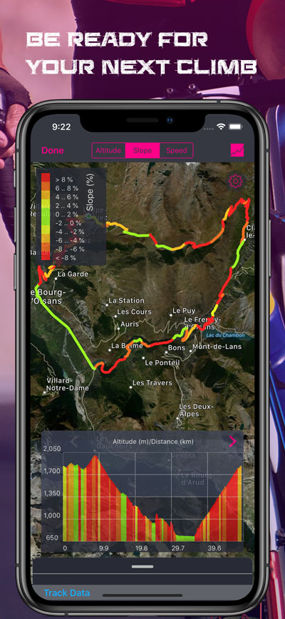
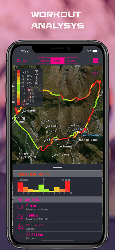
See the gradient, understand the climb — slope distribution shows exactly where it gets hard.
Your Apple Watch already recorded it — import any run, ride, or hike directly from the Health app.
Decode every climb — altitude and slope overlaid on the map, with a full elevation profile below.
Alpe d'Huez, 1071m ascent — explore iconic climbs as demo tracks, free, no account needed.
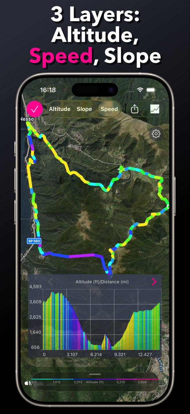
Three layers in one view — switch between altitude, speed, and slope colour overlays instantly.
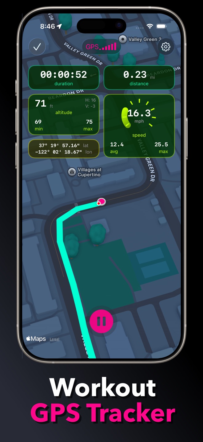
Live GPS tracking — real-time speed, altitude, distance, and coordinates as you ride.
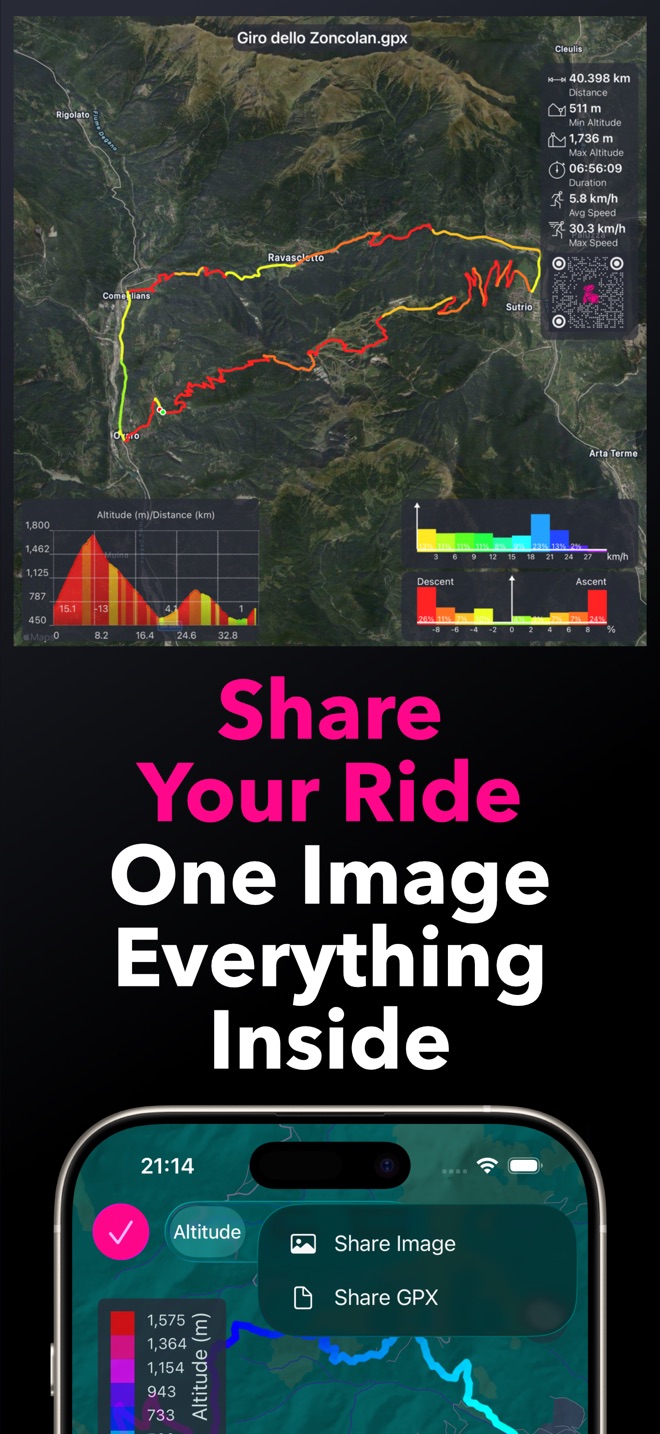
Share your ride as one image with everything inside — map, stats, elevation profile, and slope histogram.
English, Italian, French, Spanish, German
m, km, ft, mi, yds, nm, m/s, km/h, ft/s, mph, kn
Some years ago I discovered my passion for road bike on the Etna Mountain’s streets.
I like to understand the characteristics of the track that I will do or I’ve done.
So, I developed this App and I started a new career in mobile development.

Swift and Objective-C Developer
AWS Certified Engineer
I use it to view my routes for cycling purposes. It shows me great details for inclination.
- Bunnyman69 -Ottima App per tutti i bikers come me, molto completa veloce ed affidabile!!!
- Dox80 -So far, I always used online tools to analyse planned GPS tracks regarding slope gradients (i.e. Race biking, ski touring) but this is usually a bit awkward on the iPad. This app does exactly what I was looking for! Super cool! Thanks!
- franz77ferdinand -Free to download. Start analyzing your rides in minutes.